Showing posts with label Esri. Show all posts

Friday, September 19, 2014

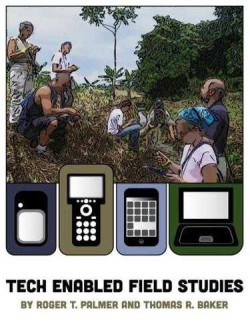
Tech-Enabled Field Studies (Book Review)

Tech-Enabled Field Studies by R.T. Palmer and T.R. Baker

Available @ http://gisetc.com/product/gps_field_studies/ for $14.99 as PDF or $29.99 as hard copy.

The book contains 10 chapters in three logical sections. Section I (Getting Started) begins with the pedagogy of field studies as inquiry-based teaching and learning and nicely expands the idea of fieldwork to other disciplines that we may not immediately associate with fieldwork such as history, mathematics, or art. Section II (Tools) includes 7 chapters explaining the tools of 21st century field studies. The emphasis here is on hardware and software for location-based field data collection by students (see Page 53 for a simple example).
  • Chapter 5 introduces the EdGIS Student Data Mapper, an easy and (almost) foolproof way to get data from the student’s smartphones into spreadsheets, Google Earth, or web-mapping services such as ArcGIS Online.
  • Chapter 6 introduces the EdGIS GeoForms tool, an effective way to turn Google Forms into location-enabled data collection and mapping forms for smartphones or tablets.
Section 3 (Techniques and Ideas) presents 5 project ideas as practical examples of tech-enabled field studies. Or, just call it citizen science!

This is a very useful book (and a quick read) for anyone interested in adding more location-based ‘tech’ into their outdoor labs, field trips, or student field data collection campaigns. Smartphones are rapidly becoming ubiquitous among students and teachers so why not! In a recent survey, over 90 percent of Westfield State students reported owning an internet-enabled smartphone, a percentage that matches national surveys. The book is a bit GIS-and Esri-heavy at times, for example Chapters 7, 9, and 10 are only useful if you are comfortable using ArcGIS Desktop and you teach at an institution with an ArcGIS Online for Organization account (Westfield State does!). The price is right, so why not get a copy for yourself and/or your department library?
Read the brief summary and review from the Esri Ed Team, watch the great 3-part video series 7 Ways to Map Your Field Data by Joe Kerski, and explore the GPS and fieldwork resources compiled by Esri.


Friday, September 12, 2014

Story Maps and Tour Builder

What are story maps? Fun ways to organize and present information in a geographic context! I think storytelling with maps can be an effective way to facilitate, scaffold, and assess student learning while using 21st-century technology. Here are a few examples:
  1. The Mount Cardigan Story Map. This map tells a simple story: hiking Mount Cardigan, but with embedded photos, videos, web links, audio, and panoramas.
  2. Costa Rica (2014). This is a similar type of story, but this time using Tour Builder.
  3. Along 40 Degrees North. Travel across the US and experience how and why the landscape changes.
  4. Light Rail in Denver. Travel along the new West Rail Line.
You can story map using Esri's Story Maps and Google's Tour Builder. They both do the same thing (sort of...) but differently. Story Maps sits on top of Esri's ArcGIS Online and therefore provides more options and analytic functions - although most people will be satisfied with the online Map Tour template. Tour Builder is still in beta (and has been for over a year - not sure what that means) and uses the Google Earth browser plug-in for 3-D tours.

Best of all you can create these maps without any special technology right now from your desk or classroom, but it is more fun with a smartphone and some fieldwork with students (using, for example, the Snap2Map app). Here's all you need to know!

Alternatives to Esri and Google are explained in these Seven Ways to Create a Storymap. Or, just try Visits or Heganoo or StoryMap JS.